MX+ MobileiOS · Android · battle-tested

MX+ gives field teams the tools to work anywhere — even offline.

MX+ is the field app for MX. Access work, complete inspections, capture photos and evidence, walk site boundaries, scan tags and wristbands, and continue working when the network is gone. Sync resumes when a connection returns — with no data loss and a complete operational record.

↳ Field-ready software for emergency and recovery operations.
WORK ORDERS
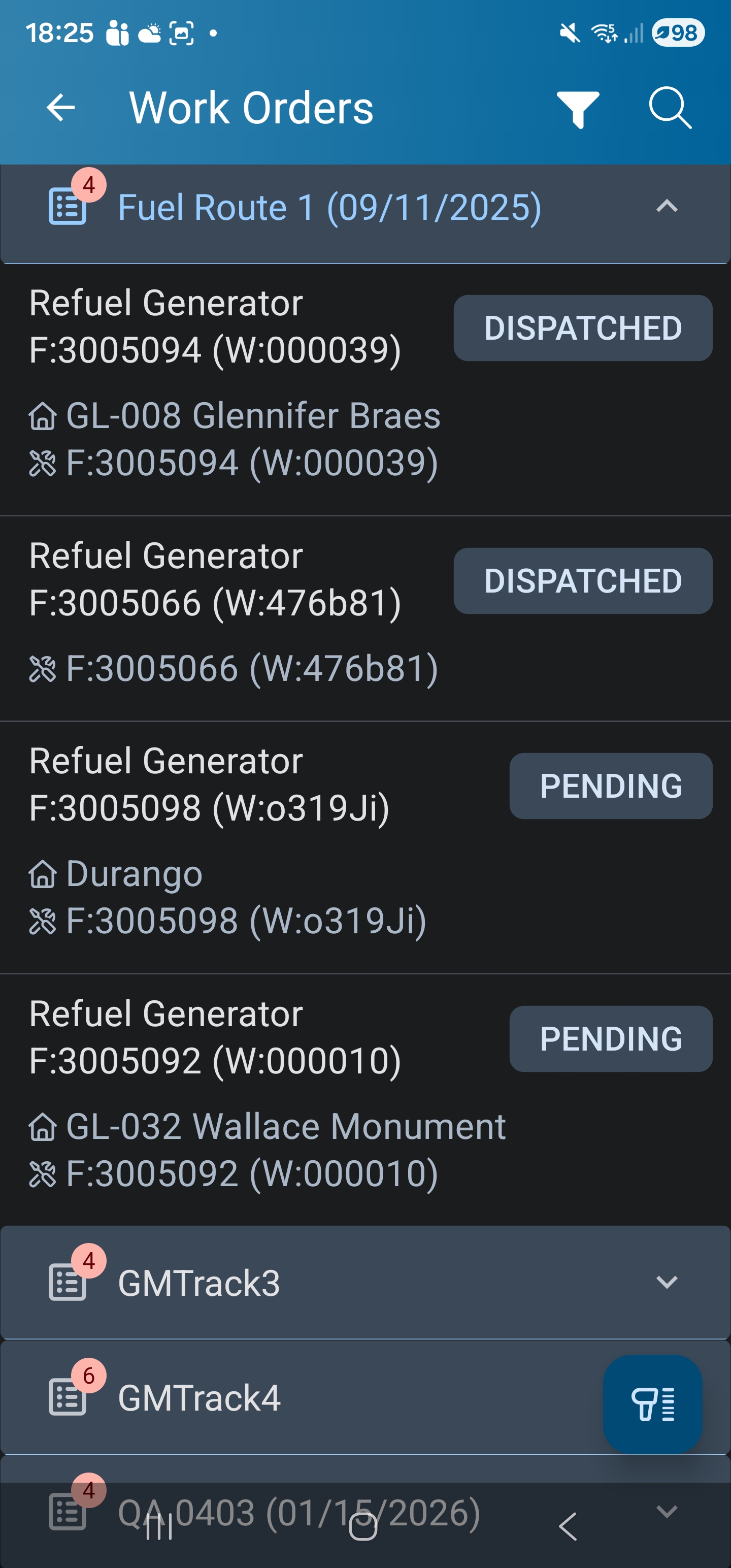
MX+ Mobile work orders list — grouped by route, with Refuel Generator tasks dispatched and pending.
FORM & EVIDENCE
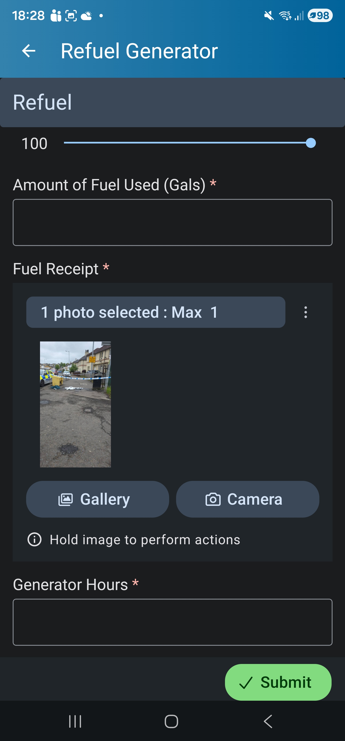
MX+ Mobile Refuel Generator form — gallons slider, fuel-receipt photo capture, generator hours, submit.
SCAN & CHECK-IN
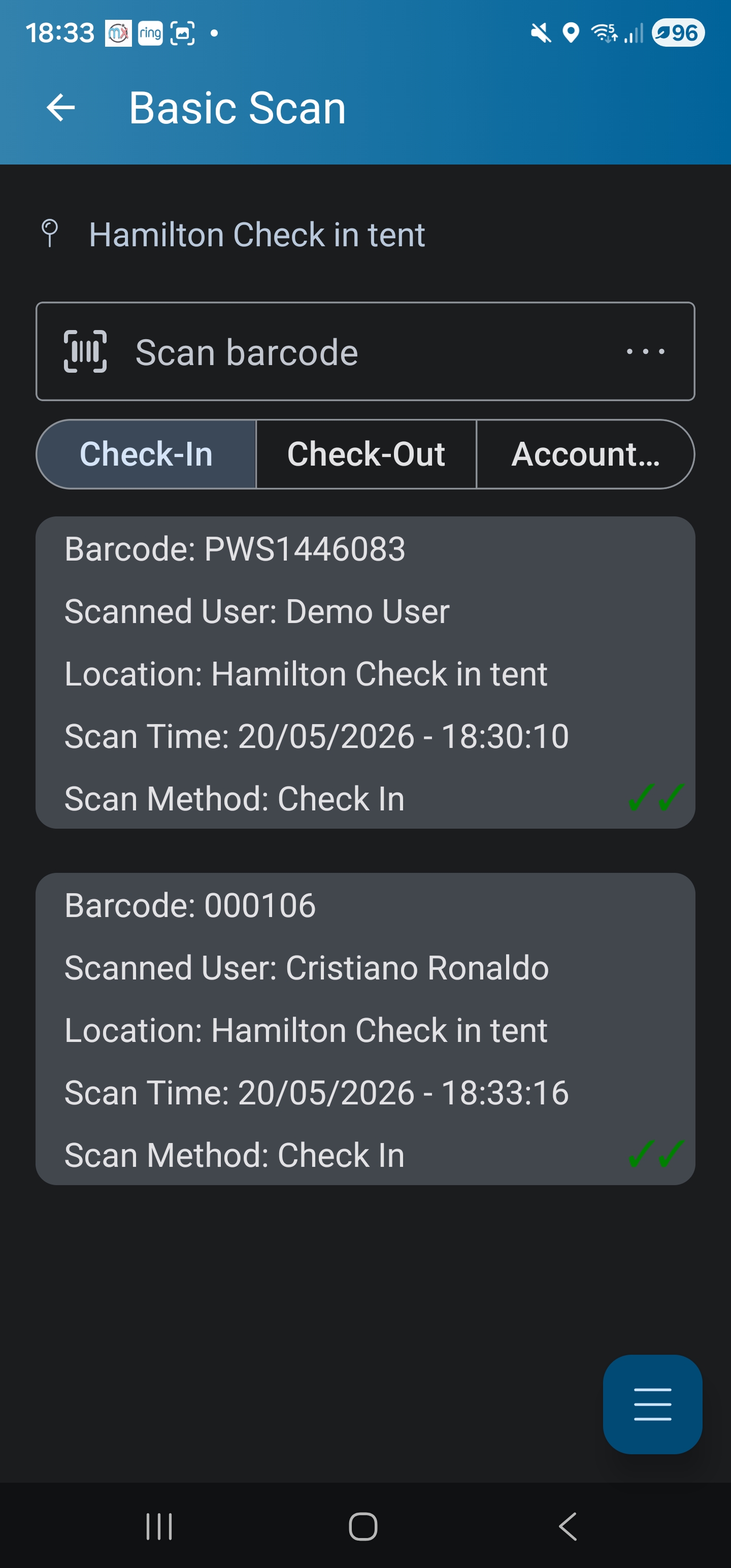
MX+ Mobile Basic Scan — Hamilton check-in tent, barcode scan with timestamped check-in records.
§ 01 · Offline-first by design

MX+ is designed for environments where connectivity cannot be guaranteed.

Field teams continue capturing work, forms, inspections, photos, and updates — then synchronise when a connection becomes available. No data loss. No surprises. A complete operational record either way.

< 100 ms
Local interaction latency
7 days+
Continuous offline operation tested
0 paper
Forms entirely on-device
OTA
Form & workflow updates without redeploy
EVIDENCE CAPTURED ON DEVICE
  • Photos — Attached to the work and the asset they were taken against, not left in a camera roll.
  • Notes — Structured where the form asks for it, free text where it does not — kept with the record.
  • Signatures — Captured on the form and timestamped with the rest of the record.
  • Geotags — Every capture carries where it happened, whether or not the device was online at the time.
  • Weather — Conditions at the moment of capture are recorded against the record automatically, so the inspection carries the context that explains it.
  • Mapped areas — Draw the area a record covers — a damaged stretch, a cleared zone, a flooded field — on the map inside the form. The shape is stored with the record, the same as a photo.
  • Site boundaries — Walk the perimeter on the phone with the live GPS accuracy reading in view. The walked shape is the boundary every map screen and zone rule uses.
§ 02 · Sync cycle

How MX+ handles intermittent connectivity.

MX+ does not assume connectivity. It captures work first, syncs when it can, and reconciles deterministically. The user never has to wonder whether their record made it.

01

CAPTURE

Work, forms, inspections, photos, scans, mapped areas, site boundaries — all captured on device.

02

QUEUE

Operations stored locally with operational metadata, geotag, and timestamps.

03

DETECT

Device detects a usable connection. Sync resumes automatically.

04

RECONCILE

Server reconciles by operation order. Conflicts surface to supervisor, not silently overwritten.

05

CONFIRM

Synced operations are confirmed on device. Anything pending stays pending.

§ 03 · Scanning & identification

QR. Barcode. NFC. Mobile wallet.

MX+ scans the tags that match your environment. The same scan can capture a check-in, identify an asset, or open a structured form — depending on what the tag is bound to in MX.

SUPPORTED TAG TYPES4 native
QR codeAsset lookup · Issue reporting · Site navigation
BarcodeInventory · Parts · Consumables
NFC tagWristbands · Badges · Access · Check-in
Mobile walletApple Wallet · Google Wallet · Dynamic ID badges — access & validity updated OTA
SCANNING USE CASES
  • Check-in / check-out at gates and zones
  • Asset lookup on-site
  • Issue reporting via QR poster
  • Meal tracking in basecamps
  • Laundry tracking
  • Bed and office assignment
  • Site movement audit
  • Equipment / trailer attestation
§ 04 · Operational environments

Where MX+ has been proven.

MX+ has been used through post-9/11 recovery in lower Manhattan, state and federal hurricane response, utilities, infrastructure, and large basecamps. The constraints listed below shaped its design.

ENV·01

Disaster zones

Cyclones, floods, fires. Variable cell coverage, fast-changing sites, rotating crews.

ENV·02

Remote sites

Substations, transmission lines, civil sites with no reliable connectivity for hours or days.

ENV·03

Basecamps

Temporary facilities — billeting, catering, sanitation, access control, issue reporting via QR.

ENV·04

Temporary facilities

Stood-up sites for recovery, events, or programmes — operational from day one.

ENV·05

Utilities & infrastructure

Inspections, damage assessment, condition reporting across distributed assets.

ENV·06

Large campuses

Multi-building, multi-zone operations with mixed in-house and contractor teams.

§ 05 · Over-the-air configuration

Change forms and workflows. Don't recall the crews.

When the operation evolves mid-deployment — and it always does — MX+ accepts micro OTA updates to forms, workflows, and reference data. Crews keep working through the change.

mx.config / publishready
$ mx publish damage-assessment --ota
→ 142 devices online, 38 offline
→ diff: +1 field (geotag_required), workflow.escalate_after 6h → 4h
✓ 142 devices updated · 38 queued
$ mx audit damage-assessment --last
v3 · published 14 May 11:18 · k.morgan
rollback available

Micro-updates

Form changes, field additions, conditional logic — pushed without an app store release.

Per-device delivery

Online devices get the update immediately. Offline devices receive it on next connection.

Versioned & audited

Every published change is versioned, peer-reviewable, and reversible. Rollback is a single command.

No crew recall

Crews continue working through the change. The next form they open uses the new version.

Explore MX+ Mobile

Field-ready
mobile operations.

See MX+ in the kind of environment you operate in — patchy connectivity, mixed crews, fast-moving sites.

Explore MX+ Mobile See MX+ for emergency operations